Quinag and Kylesku
A breathtaking mountain range in amazing Assynt featuring precious remnants of ancient oak woodland... Plus some cozy lodges to explore it all from.
Our land in north Assynt comprises three adjoining sites: Quinag covers 3,699 hectares (equivalent to 5,180 football pitches) of the Assynt–Coigach National Scenic Area in Sutherland; plus part of the Kylesku Estate that covers an additional 166 hectares and 11 cozy Kylesku Lodges on an 18 hectare site.
Quinag is an anglicisation of its Gaelic name, A’ Chuinneag (meaning the milk pail). It’s not a single mountain but a dramatic range of peaks. Sàil Gharbh means the rough heel, Sàil Ghorm the blue heel, and Spidean Coinich is the mossy peak. These are three of Scotland’s most northern Corbetts (hills over 2,500ft).
The open hillsides here are a mosaic of heather moorland, grassy slopes and peat bogs. Remnants of ancient woodland comprising birch, rowan, hazel, wych elm, aspen and oak are scattered throughout the northern side of Quinag particularly in the deep gulleys.
Quinag was part of the ambitious Coigach and Assynt Living Landscape project. This aimed to reconnect woodlands and other fragmented habitats to enable missing species to return.

What we're doing
The John Muir Trust is working to protect the integrity of the wild landscape at Quinag – the sweeping mountain ridges, mountain views, quiet corries, tumbling burns and vibrant woodlands – for people to enjoy and for the benefit of the wildlife it supports. We maintain the mountain path to the summits and work to restore deer populations to levels that the land can sustain.
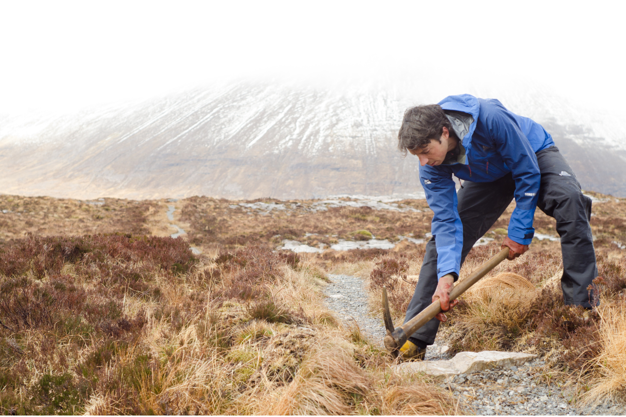
Pathwork
Through our Wild Ways programme, the Trust maintains the mountain path up Quinag. This enables access to the summits and their stunning views over the peaks and lochans of Sutherland, and beyond. Our skilled path team helps prevent damage to fragile habitats and the wider landscape without being intrusive.
Deer management
Many habitats on Quinag, particularly native woodland, have declined and disappeared. This is due to centuries of heather burning, overgrazing by sheep and an unsustainable rise in deer numbers. We’re working to reverse this decline and encourage nature to develop a rich variety of wild landscapes and habitat. This is particularly important for saving the ancient Ardvar Woodlands on the north side of Quinag. Deer are an essential part of the ecosystem, but their high numbers are preventing young trees from growing here.
Following three years of increased deer culls - between 2022 to 2025 - the average marked seedling height has increased from around 49cm to 64cm. The percentage of marked trees with their leader shoot browsed (at point of measurement in late spring each year) has dropped from around 60% to 32%.
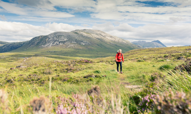
Exploring Quinag
Assynt is a hill walker's paradise, with Quinag one of the most popular mountains. From Kylesku Bridge, you can see the two great northern buttresses of Sàil Mhor and Sàil Ghorm. From the foot of Loch Assynt, its cliff-lined flanks fill the horizon, and from the loch head at Inchnadamph its three tops rise above spacious moorland, with Ardvreck Castle in the foreground. The summits offer stunning vistas of wild Scotland, looking west across the Minch to the Isle of Lewis and north to the mountains of north-west Sutherland.
Quinag lies within the North West Highlands Geopark, Scotland’s first Geopark, due to the area's striking and ancient geology. The base of Quinag around the shore of Loch Assynt was formed of Lewisian Gneiss rock three billion years ago.
- Please be sure to follow the Scottish Outdoor Access Code if you are visiting.
Looking for somewhere to stay near Quinag?
Support the work of the Trust by staying in one of our stunning lodges at Kylesku.
Book for Kylesku Lodges
